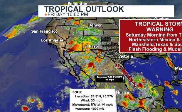
According to the National Hurricane Center, a tropical storm warning has been issued from Port Mansfield, Texas, to Boca de Catan, Mexico. The National Hurricane Center has classified a system in the southern Gulf of Mexico, about 400 miles south-southeast of the mouth of the Rio Grande, as Potential Tropical Cyclone Four. This system is the subject of the warnings.
Before a system is officially designated, the hurricane centre utilises the possible tropical storm designation to issue warnings for it.
“Since the system is likely to develop further and make landfall as a tropical storm in less than 36 hours, advisories are being initiated on Potential Tropical Cyclone Four with tropical storm warnings being issued for portions of the coasts of northeastern Mexico and South Texas,” the Hurricane Center said in its forecast discussion.
Regardless of development, the system is expected to bring heavy rain to northeastern Mexico and extreme southern Texas. Rainfall amounts of up to eight inches are possible in Mexico, and one to three inches expected in far South Texas.
Meanwhile, the rest of the desert Southwest, an area dealing with long-term megadrought, is bracing for a moderate risk, Level 3 of 4, of extreme rainfall, which could lead to flash flooding Friday and Saturday.
“A multi-day significant rainfall event is forecast across the Southwest US this weekend,” the Weather Prediction Center said. “Impactful rainfall is most likely across parts of southeast Arizona into southwest New Mexico with storm total amounts approaching 5-6 inches.”
Flood watches are posted for nearly 10 million people across the Southwest, including Tucson, Phoenix, Albuquerque, and El Paso, through Saturday.
See if rain is expected where you live right here >>>
Zack Taylor, a senior meteorologist at the Weather Prediction Center, pointed out there are multiple factors creating the new surge of moisture, including the remnants of a tropical wave currently over northern Mexico embedded within the larger-scale monsoon.


